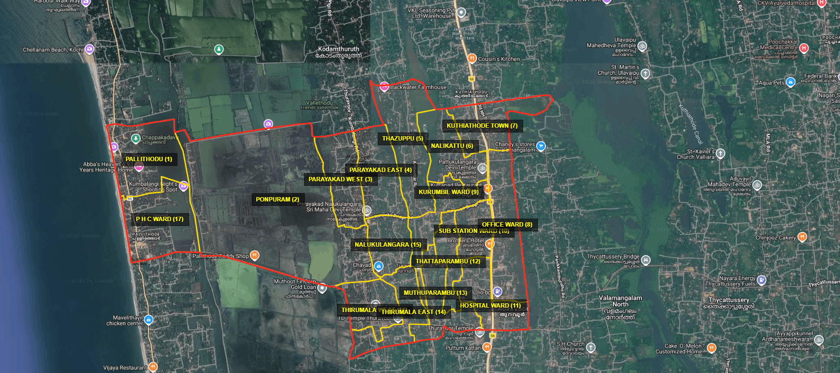

MAP
Kuthiyathode Grama Panchayat is a local self-government institution situated within the Pattanakkad Block of Cherthala Taluk in Alappuzha District, Kerala. The Panchayat covers an area of 9.8 square kilometres.
It is bounded by the Arabian Sea on the west; Kuthiyathode Canal and Changaram Thodu on the north; Thonithodu on the east; and portions of the Thuravoor–Thaikkattussery Road, Thuravoor–Kumbalangi Road, and Chavadi–Pallithodu Road on the south.
The area now known as Kuthiyathode was originally called Thuravoor North. It is believed that the name Thuravoor originated from the Sanskrit word “Surapuri.” The term Surapuri means “the land of the gods.”
Researchers suggest that this stretch of land, located between the Arabian Sea and Vembanad Lake, was formed by marine deposition several centuries ago, as the sea gradually created and shaped the terrain over time.